
Images from Pinnacles Soil Profile Analysis
Posted: Wednesday, November 1st, 2006
Misc. scanned images from work at the Pinnacles National Monument, in collaboration with the NRCS and NPS. These images are the prototypes for many of the new educational materials being developed for the visitor's center and online interface to soils information. Over 300 pit descriptions were collected by NRCS staff and myself, and are currently being digitized with our own pedon management system, PedLogic. Numerous techniques for the automation of soil survey operation, digitial soil mapping, and field assistance are currently in development. Many of the detailed features which will not appear in the final soil survey product will be featured in bulletins written up for the PINN interpretive staff. It is our goal to assist the park staff in communicating the importance of soil resources as the active junction between the biosphere and the lithosphere. GIS tools used include: GRASS, PostGIS, R, GMT, and many others. A digital version of the pedon description form illustrates some of the visualization capabilities of PedLogic.
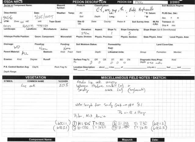
Pedon description form front page
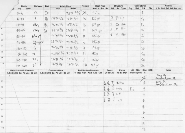 Pedon description form back page
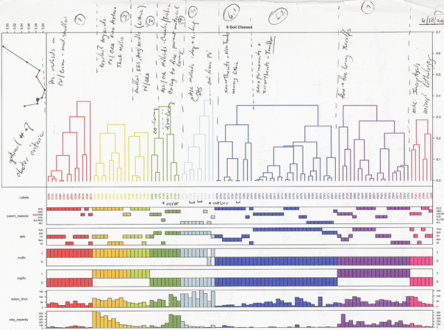
Pedon clustering
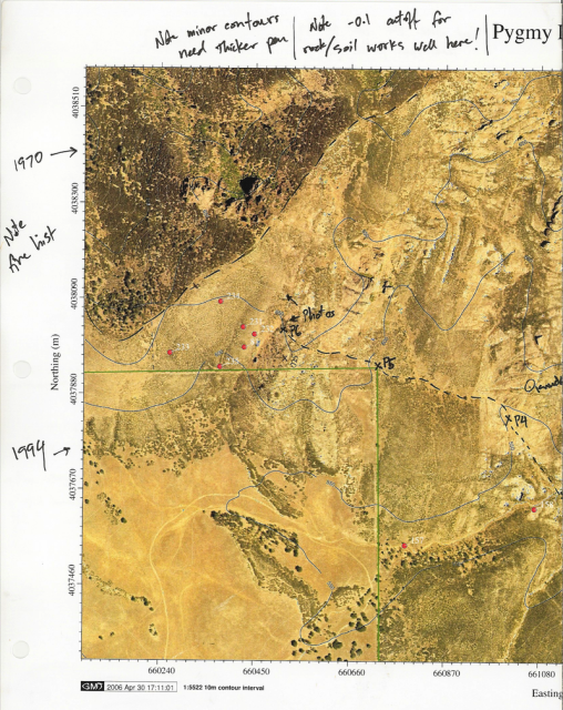
Pygmy area map
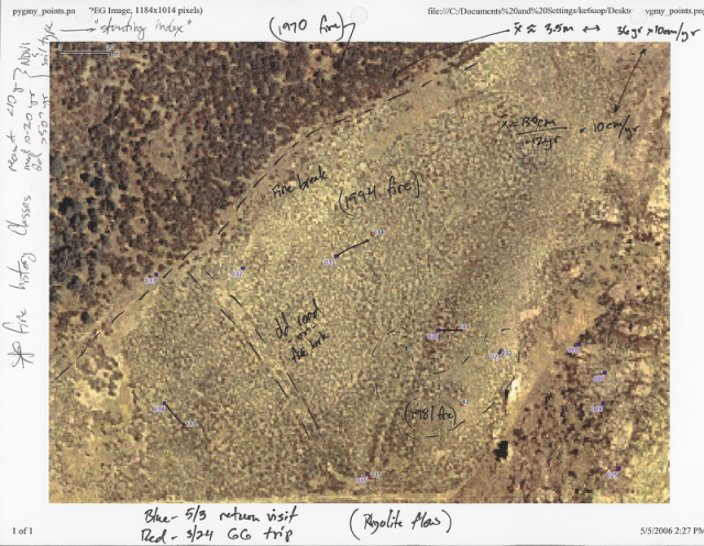
Pygmy fire map 2D
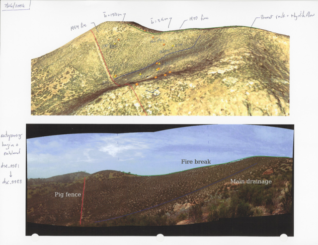
Pygmy fire map 3D
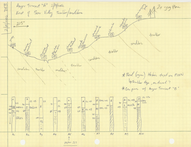
Arkose area transect
Links:
Finding pockets of soil between the Pinnacles
Pinnacles National Monument
Islands of Fertility: Oak Tree vs. Buckwheat Savannah Soils
